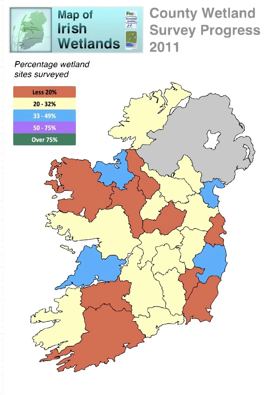
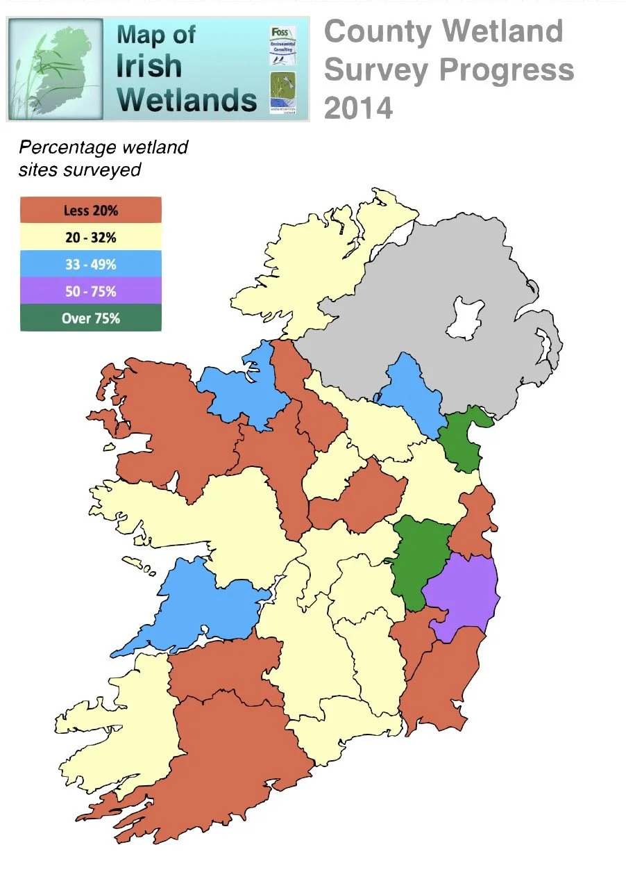
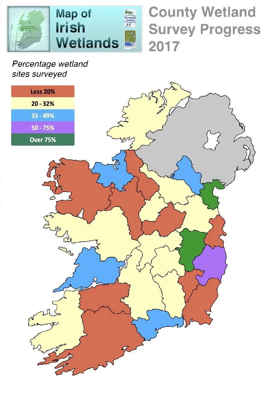
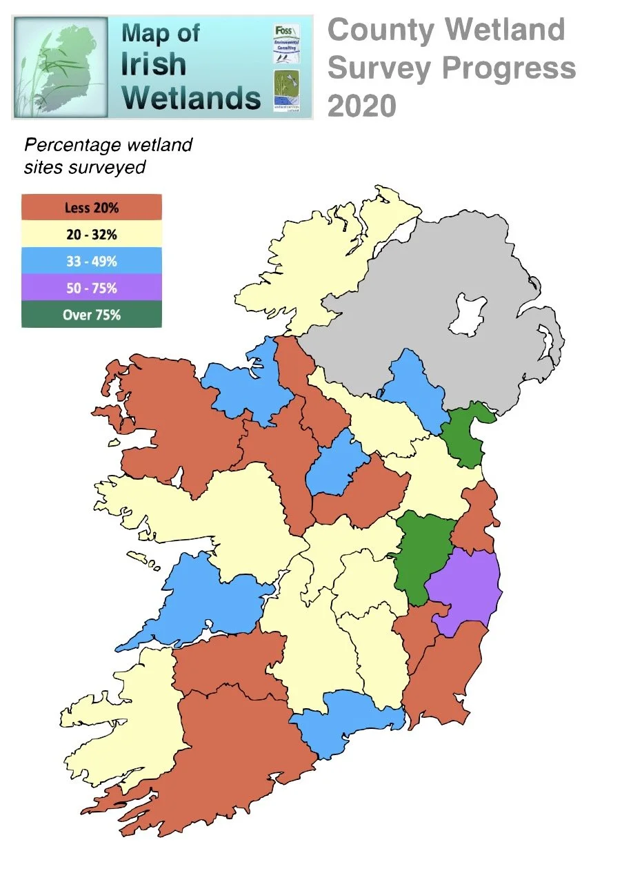
Status of sites displayed by county

Map of Ireland showing county wetland survey progress in 2025. Different counties are colored to indicate percentage of wetland sites surveyed: less than 20% (orange), 20-32% (yellow), 33-49% (blue), 50-75% (purple), over 75% (green).
Map of Ireland showing county wetland survey status in 2025, with color codes for survey completion levels across different counties.

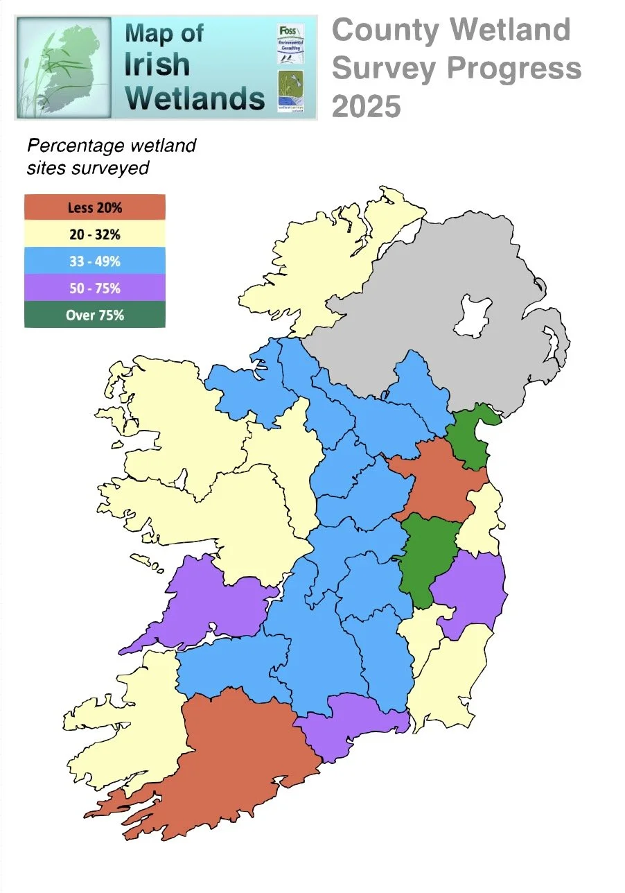
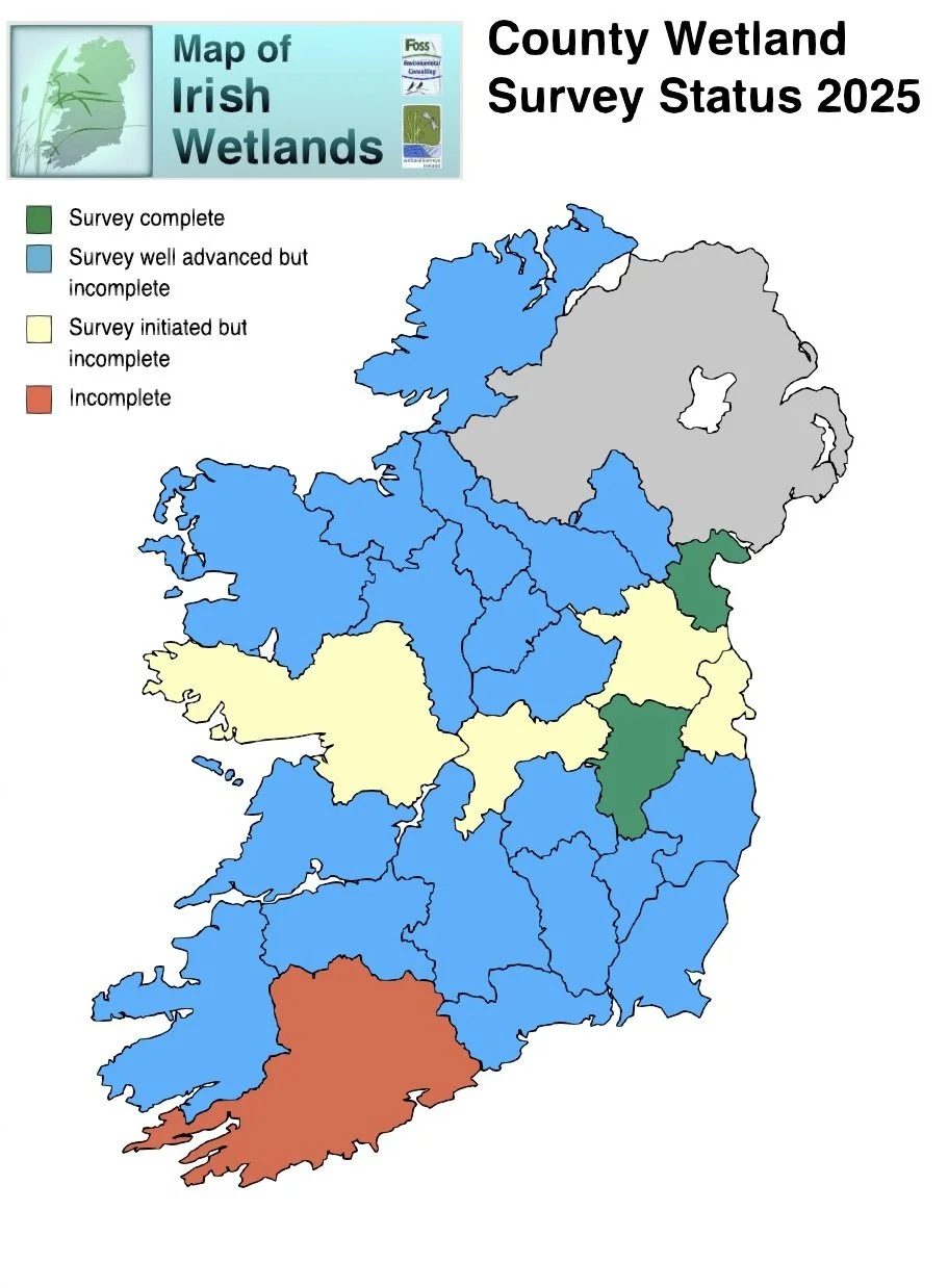
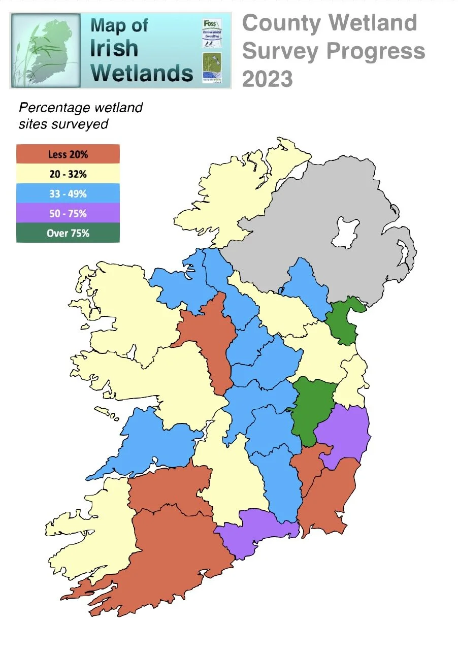
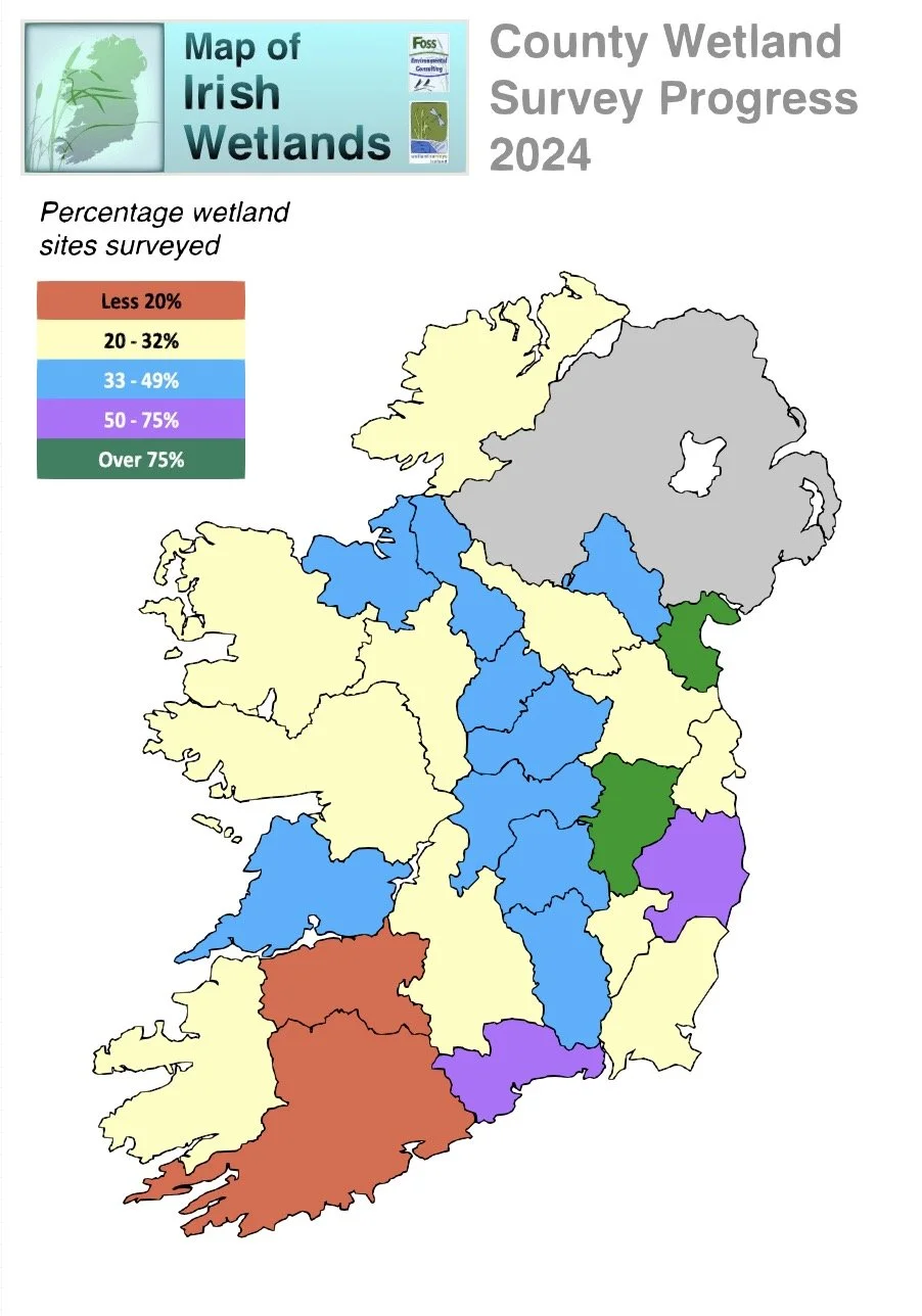
Due to the absence of targeted wetland surveys in many counties, our knowledge of the national wetland resource in Ireland remains incomplete.

An indication of the number of wetlands currently mapped in each county; the status of our knowledge of the wetland resource in each county; and sites that require a wetland survey is presented in the table below.

Last update: 16 February 2026

Table showing Irish counties, wetlands mapped, survey statuses, and inventory updates; includes counts and statuses such as 'Well advanced, but incomplete' and 'Complete wetland inventory presented'.

Status of County Wetland Surveys

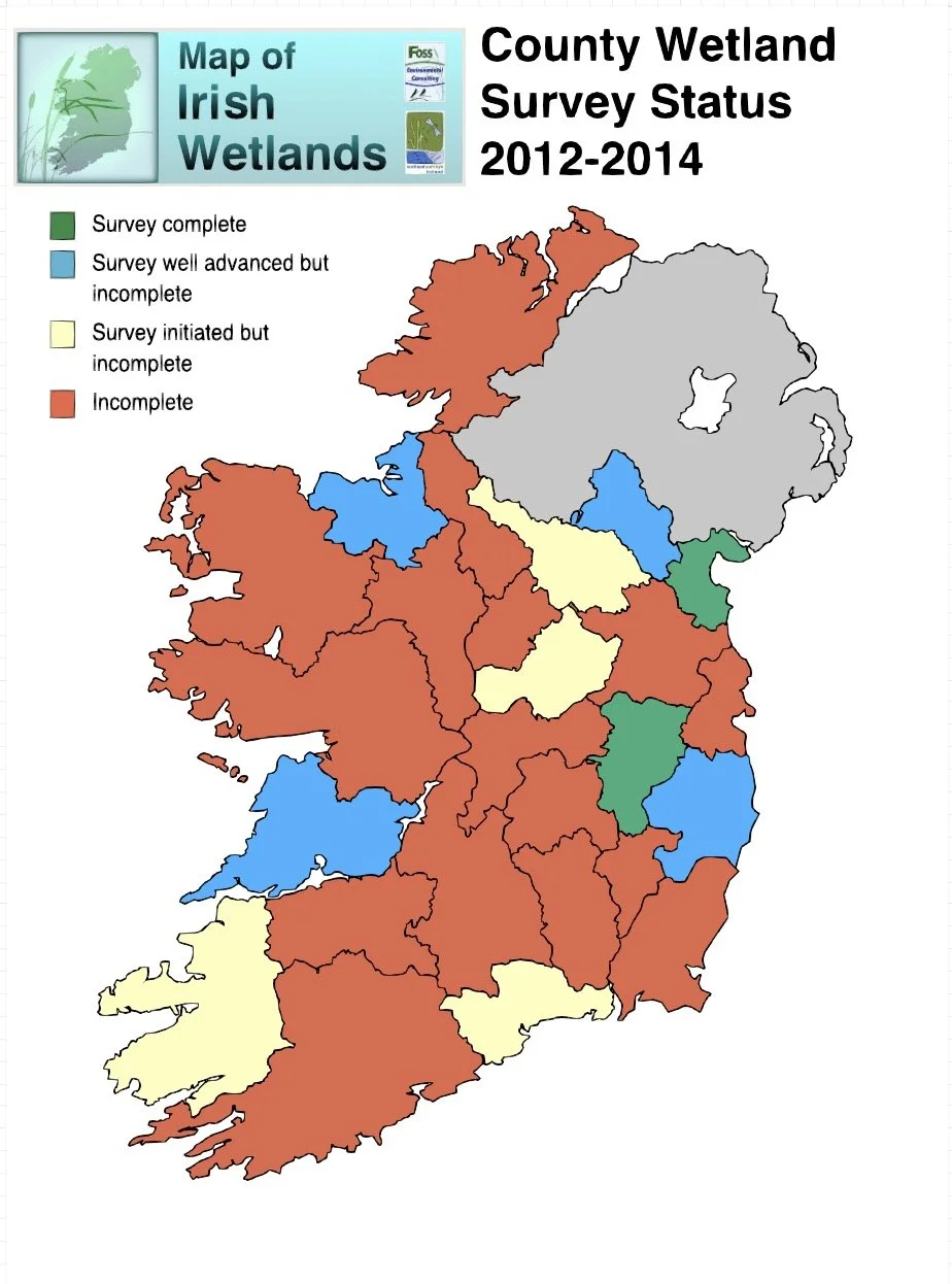
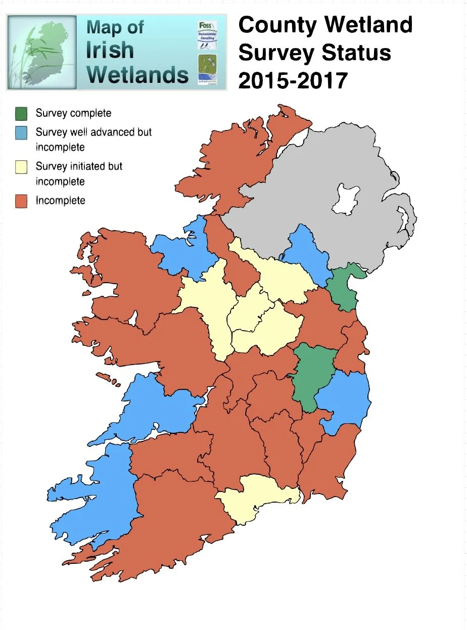
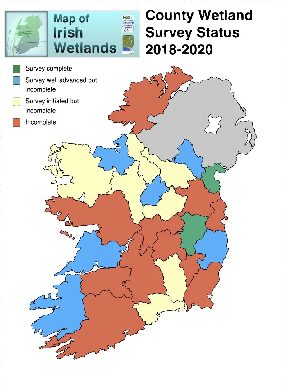
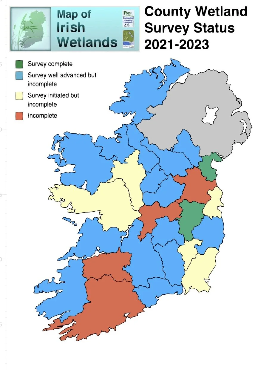
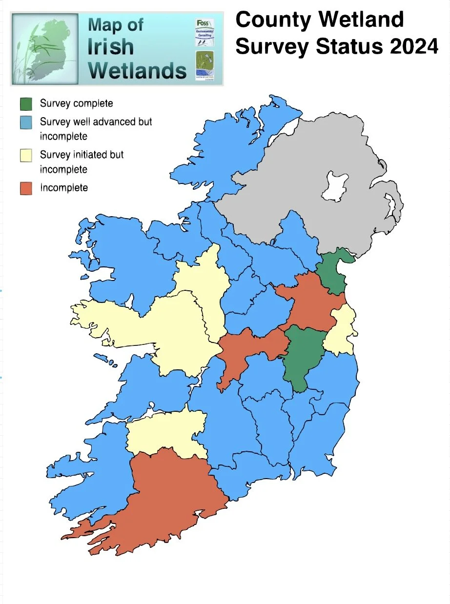
Wetland Survey progress