
Committed to Excellence
Our team of experienced ecologists has the necessary expertise to carry out a wide range of surveys of habitats, flora and fauna. This includes detailed assessments of both terrestrial and aquatic freshwater and coastal habitats and species on sites of all sizes. We have undertaken surveys on behalf of the National Parks and Wildlife Service, local authorities, local environmental groups, engineering firms, and private developers.
Our work is carried out to the highest standards of scientific accuracy and using best available technology. We produce maps and reports of publication quality and place special emphasis of delivering results on time and within budget.
Our client services include:
Further details are provided below
Ecological Impact Assessment
Wetland Surveys have carried out Ecological Impact Assessments on a wide range of projects from single one off houses for private clients to larger infrastructural developments for semi-state bodies. We are usually involved throughout the design and planning stage of each development and often continue our involvement through the construction and operation phase to ensure clients are compliant with any statutory requirements relating to ecology throughout the lifetime of the project

Appropriate Assessment
Wetland Surveys have prepared a number of Appropriate Assessment Screening Reports and Natura Impact Statements for developments throughout Ireland ranging from the installation of small scale one off housing developments, solar and wind energy projects, quarries to large scale regional infrastructural projects on behalf of semi-state bodies.
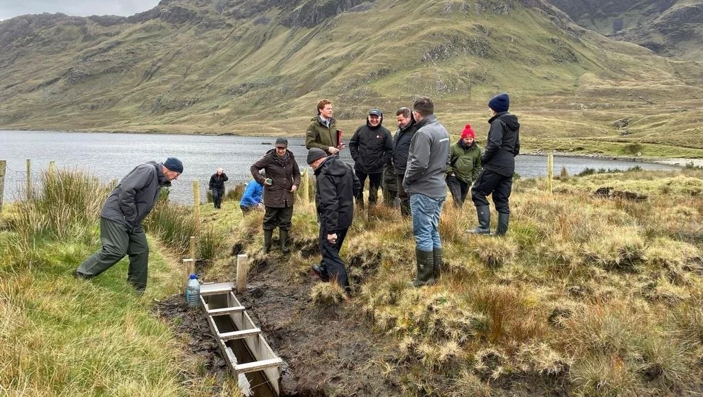
Agri-Environmental Projects
Wetland Surveys has developed and run two successful locally led European Innovation Partnership (EIP) programmes, the Pearl Mussel Project and the FarmPEAT Project and is a lead partners on the ACRES West Connacht Co-operation project. These projects facilitate local farmers, researchers, and advisors to work together to develop a programme to ensure long term coexistence of farming and target species or habitats in Ireland.

Ecological Monitoring
Our team can establish baseline data for monitoring change in hydrology, water chemistry, vegetation, fauna or other natural features, for any site. This is done using techniques such as standard quantitative sampling, aerial photography, GIS and fixed point photography.
Ecological Clerk of Works
We have worked as Ecological Clerk of Works on a number of large infrastructure projects. The primary role is to advise on compliance with the environmental planning conditions, such as hydrology, noise, air quality, river and land pollution, protected species and landscape, with preparation of compliance reports for clients and stakeholders and advisory reports for site managers/staff.

Wetland Surveys and Mapping
Wetland Surveys use the latest GPS survey equipment together with GIS mapping software to produce detailed habitat maps and for the management of spatial data. Wetland Surveys Ireland have particular expertise in surveys of terrestrial wetland habitats including bogs, fens, swamps and marshes. Since 2007 we have undertaken wetland survey projects and field surveys in Counties Carlow, Cavan, Clare, Donegal, Galway, Laois, Leitrim, Limerick, Longford, Louth, Kildare, Kerry, Mayo, Monaghan, Roscommon, Sligo, Tipperary, Waterford, Wexford and Wicklow on behalf of the relevant local authorities.

Aerial UAV Surveys
Wetland Surveys has undertaken a number of UAV eco-drone aerial surveys as part of ecological, development and monitoring projects. Benefits and advantages of eco-drone surveys: Obtain a comprehensive and accurate bird’s-eye view of development or survey area; Ability to survey inaccessible areas or sites where health and safety issues are present ; Assist with habitat mapping and monitoring projects by collection of geo-referenced high-resolution photographs and video footage; Substantial time saving when mapping larger sites; Cost savings to clients.

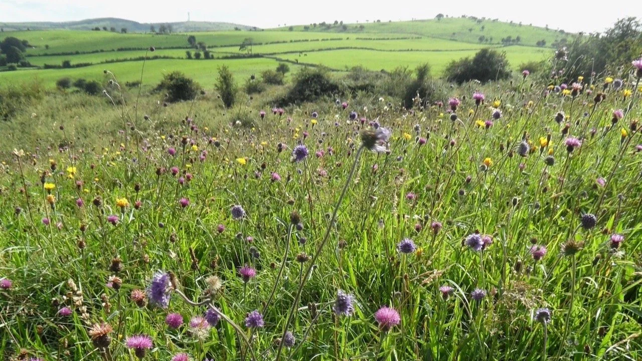
Flora, Fauna and Bird Surveys
Our ecologists have the experience and resources to allow detailed analysis of vegetation data. We have experience of applying the National Vegetation Classification (NVC) system in classifying plant communities on various projects in Northern Ireland. All bird surveys are undertaken by suitably qualified and experienced ornithological surveyors and in accordance with national and international standards of best practice. We regularly undertake surveys for the following faunal groups: Terrestrial mammal surveys (with emphasis on protected species including badgers and otters); Terrestrial invertebrate surveys (including Marsh Fritillary and Kerry Slug); Trail camera mammal movement surveys.

Native Woodland Conservation Scheme
Wetland Surveys has approved ecologists on the Native Woodland Conservation Scheme administered by the Department of Agriculture. The ecologists role in the Native Woodland Conservation Scheme is to assess the suitability of sites and prepare appropriate restoration management plans in association with an approved forester.

Invasive Species Surveys
We have surveyed and advised on the eradication and control measures of invasive alien species (Japanese Knotweed (Fallopia japonica), Himalayan Balsam (Impatiens glandulifera) and Rhododendron (Rhododendron ponticum) for the preparation of a biodiversity conservation plan for Reenagross Park, Kenmare, Co. Kerry. We have also undertaking pre-construction invasive species surveys along underground grid connection routes, such as at the Knockanure to Kilpaddoge 220kV cable route.

Biodiversity Surveys & Action Plans
We have undertaken biodiversity surveys of range of towns, villages, parks, and industrial facilities and prepared actions plans to manage and enhance the biodiversity value of these locations.

Biodiversity Information & Training
We have created a range of publications and on-line wetland, biodiversity and education information story maps and run biodiversity information training events for private groups, county councils and businesses.
Other client services we have provided
Advice on wetland management, natural history & wise-use
Bare peat restoration – Geo-jute/Geogute installation / Heather Brash
Carbon balance calculations of wind farms on peatland sites
Coastal and Inland waterway surveys using motor boat
Design and implementation of ecological research projects
Expert evidence at oral hearings
GIS mapping of ecological data
Guidelines on best ecological practice
Habitat management, restoration and creation
Interactive online ESRI story map development
Mammal surveys using infrared trail cameras
Mapping of habitats, site data and species distribution
Nature photographic service
Preparation of Natura Impact Statement
Public awareness campaigns, teaching and educational training
Site habitat and species monitoring
Specialist advice on wetland habitats (bogs & fens)
Technical advice during design and construction