
Factfile 1: Wetlands in Ireland an Introduction
Wetland is a collective term for ecosystems (habitats and their associated species) whose formation has been dominated by water, and whose processes and characteristics are largely controlled by water. A wetland is a place that has been wet enough for a long enough time to develop specially adapted vegetation and other organisms (Maltby 1986).
They occur where the water table is at or near the surface of the land, or where the land is covered by a layer of shallow water, either throughout the entire year or seasonally.
The 1971 Ramsar Convention on Wetlands of International Importance defines wetland as:
“areas of marsh, fen, peatland or water, whether natural or artificial, permanent or temporary, with water that is static or flowing, fresh, brackish or salt, including areas of marine water the depth of which at low tide does not exceed six meters”.
In addition, for the purpose of protecting coherent sites, Article 2.1 of the Ramsar Convention, to which Ireland is a signatory, provides that wetland sites:
“may incorporate riparian and coastal zones adjacent to the wetlands, and islands or bodies of marine water deeper than six meters at low tide lying within the wetlands”.
Five major wetland types are generally recognized:
marine (coastal wetlands including coastal lagoons, rocky shores, and coral reefs);
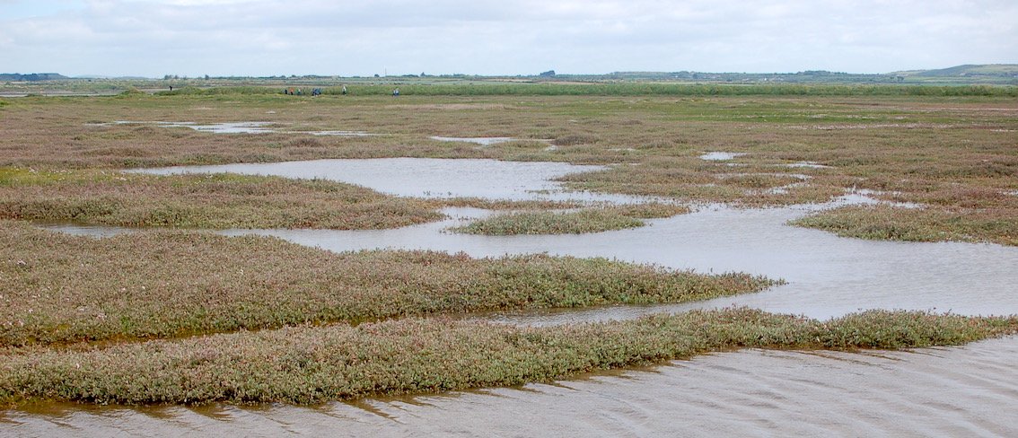
estuarine (including deltas, tidal marshes, and mangrove swamps);
lacustrine (wetlands associated with lakes);
riverine (wetlands along rivers and streams); and
palustrine (meaning “marshy” – wet grassland, marshes, swamps and bogs).
In addition to naturally occurring wetlands produced as a result of natural environmental processes, there are artificial wetlands such as fish ponds, farm ponds, irrigated agricultural land, reservoirs, gravel pits, sewage treatment facilities, and drainage ditches.
Even in certain, so called “natural” wetland systems, human-kind has played a major factor in wetland formation since pre-historic times. In Ireland, forest clearance in the uplands helped trigger soil and vegetation changes, which altered the hydrology and led in some places to bog formation. And today, since some of these bogs have been harvested for fuel and their peat deposits removed, the flooding of the abandoned peat diggings has created new shallow lakes, with marginal fens and marsh areas.
In contrast to some other habitat types (e.g. woodlands), wetlands are therefore often young and dynamic ecosystems, changing in a relatively short period of time as vegetation changes, sediments are laid down, and local hydrological conditions are altered.
One other concept that should be born in mind when considering wetlands is that a specific wetland area is often composed of many different habitat types, which form a mosaic. For example, a cutover bog wetland, may in fact comprise small areas of regenerating fen and bog communities, pools, drainage ditches, and even deeper water pools or small lakes.
On a global scale wetlands occur everywhere, from the tundra to the tropics. How much of the earth’s surface is presently composed of wetlands is not known exactly. The UNEP-World Conservation Monitoring Centre has suggested an estimate of about 570 million hectares (5.7 million km2) of wetland – roughly 6% of the Earth’s land surface – of which 2% are lakes, 30% bogs, 26% fens, 20% swamps, and 15% floodplains.

You might also like to check out Leitrim County Council & Wetland Surveys video entitled “Wetlands in Letrim”.
In the video Patrick introduces us to some wetlands in Leitrim and explains their importance for our heritage, biodiversity, and the ecosystem services they provide, such as carbon storage and flood control.
Watch the youtube video at: https://youtu.be/59KXtp6VR7c
You can also learn more about wetlands in one of Wetland Surveys story maps